Minnesota is a state located in the Upper Midwest region of the United States.
The state is known for its abundance of natural resources and its picturesque landscapes.
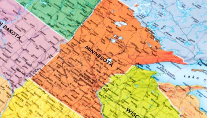
The state is bounded by Lake Superior and the Canadian province of Manitoba to the north, by the states of Wisconsin and Iowa to the south, and by the Mississippi River to the east.
Minnesota is a leading agricultural state, producing a wide variety of crops and livestock.
The state is a top producer of soybeans, corn, wheat, and hogs. Minnesota is also a leading producer of turkeys, and it ranks high in the production of sugar beets, dry beans, and potatoes.
Dairy farming is also an important part of the state’s agricultural industry.
Plant Hardiness Zone Map
Firstly let us check the zone of the state of Minnesota using the US Plant Hardiness Zone Map.
Plant Hardiness Zone Map for Minnesota

Climate
Minnesota has a humid continental climate with warm and icy winters in northern two-thirds of the state.
The remaining portion in the south falls under the hot-summer subtype with hot summers and cold winters.
The state zone ranges between 3 and 5a. Temperatures drop to extreme levels in Minnesota due to frequent polar air outbreaks in the cold season that occasionally extend to the rest of the year.
Summers range from warm to hot, with temperatures around 90˚F in the peak of July.
Winters are cold and snowy in the north and slightly mild in the south.
Temperatures of -30°F are typical in the northern parts in the coldest month of January.
Precipitation
The average annual rainfall ranges from 19 inches in the northwest to 35 inches in the southeast of Minnesota.
Snowfall is highest at 70 inches in the northern highlands of Lake Superior and decreases to 40 inches in the south and west.
Soil Type
The below map shows the distribution of soil orders in the state of Minnesota.

Now, let us discuss these soil orders in detail.
Soil Order Of Minnesota
| Soil / Sub Order | Location | Characteristics |
|---|---|---|
| Alfisols/Aqualfs and Udalfs | They are found in the Uplands and the moraines region of the state | 1. Aqualfs have warm and aquic conditions. 2. Udalfs have a udic moisture regime. |
| Inceptisols/Udepts | In the northeastern part of the state | 1. Udepts are mainly freely drained Inceptisols that have a udic or perudic moisture regime. |
| Entisols/Aquents and Psamments | Aquents in the Agassiz lowlands and Psamments in the Chipewwa plains and Hardwood hills | 1. Aquents are the wet Entisols 2. Psamments are sandy soils. |
| Mollisols/Aquolls and Udolls | Aquolls in the Red River Prairie and Minnesota river prairie while Udolls in the Hardwood hills and southeastern and southwestern side of the state. | 1. Aquolls are the wet Mollisols. 2. Udolls are the more or less freely drained Mollisols of humid climates. |
| Histosols/Hemists and Saprists | Hemists in the northeastern part and Saprists in the Agassiz lowlands and Aspen parklands | 1. Hemists are the wet Histosols in which the organic materials are moderately decomposed. 2. Saprists are the wet Histosols in which the organic materials are well decomposed. |